Read paper IEEE Xplore Code & models on GitHub Watch the talk Slides
Labels for satellite imagery are scarce and expensive. Can a self-supervised representation learned on one remote-sensing dataset transfer to another — and beat full supervision with a fraction of the labels?
The problem
Most remote-sensing vision work relies on fully supervised learning. But annotating satellite imagery takes domain expertise and is costly, so labelled data is always limited. That makes knowledge transfer — pretraining once and adapting to new data — a practical necessity.
Approach
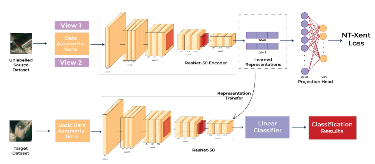
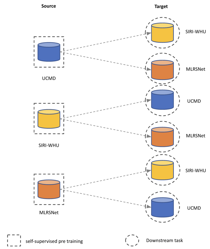
We study contrastive self-supervised pretraining (SimCLR, ResNet-50) and how its representations transfer across distinct source and target distributions within remote sensing. Pretraining runs on a source dataset; downstream classification runs on each target dataset in a round-robin, across different label budgets.
Datasets
| Dataset | Classes | Images | Notes |
|---|---|---|---|
| UC Merced Land Use (UCMD) | 21 | 2,100 | USGS urban imagery, 1-ft resolution |
| SIRI-WHU | 12 | 2,400 | Google Earth, metropolitan China |
| MLRSNet | 46 | 109,161 | 10 m to 0.1 m resolution |
Results
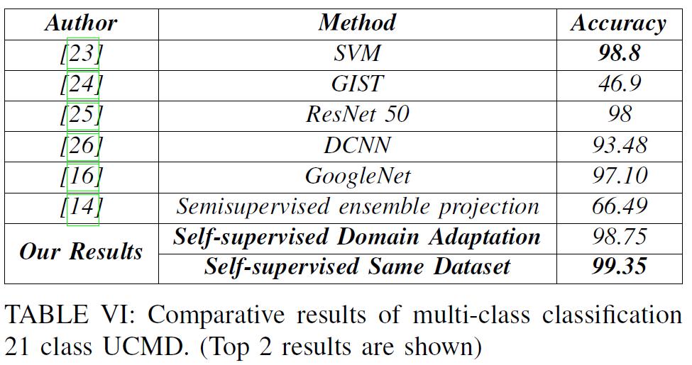
Self-supervised knowledge transfer reaches state-of-the-art performance with high label efficiency and outperforms the fully supervised setting. Qualitative analysis shows consistent evidence of explainable representations.